Project Status: In Progress
Delivery Partners/Stakeholders:
Bedfords Park: Friends of Bedfords Park, London Borough of Havering
Pages Wood: Forestry England
Thames Chase Forest Centre: Thames Chase Trust
Langdon Hills: Thurrock Council
Davy Down: The Land Trust
High House Production Park: High House Community Group
Eastbrookend Country Park: London Borough of Barking and Dagenham
Valence House: London Borough of Barking and Dagenham
In order to help create the sense of a unified, connected landscape, it is critical that key messages, stories and connections are made evident at gateway locations throughout the Land of the Fanns. Guided by the Interpretation Strategy and Landscape Character Assessment developed during the development phase, the ‘Interpreting the Fanns’ project focusses on achieving this aim by delivering interpretation that is locally relevant yet clearly connected to a bigger whole.
Given the number of locations and stakeholders involved, it will be necessary to develop interpretative guidelines so that partners are able to translate the principles and strategy into practical instructions for consistent project delivery across the Land of the Fanns. This has been taken forward by the Interpretation Strategy developed during the development phase. When delivering at each location, the content will need to be shaped to reflect the landscape significance as defined in the Landscape Character Assessment. The method of signage and interpretation will need to reflect the location and context. Consequently, the project is comprised of two phases:
1. Interpretive Plan
2. Delivery of Interpretation
1. Interpretive Plan
Whilst the principles, themes, methods and plan for interpretation were established during the development phase, there were insufficient resources to translate this into a full plan that partners can use to guide delivery within their location. Consequently, further development work will be required during Year 1 of the Scheme to complete the interpretation planning process.
This project plan will need to be updated once this process has been completed.
2. Delivery of Interpretation
This second phase will deliver signage and interpretation at strategic locations across the landscape with content joined up in line with the Interpretation Strategy and the method tailored by the location. The Landscape Character Assessment identified areas of distinct landscape significance that will need to be reflected through the signage and interpretation to help build audience understanding:
A. Belhus Lowland Quarry Farmland
B. Brentwood Wooded Hills
C. Dagenham Corridor
D. Havering Wooded Hills
E. Ingrebourne Valley
F. Langdon Hills and Farmland
G. Mardyke
H. Orsett Lowland Hills
I. Rainham, Aveley and West Thurrock Marshes
J. Thurrock Reclaimed Fen
K. West Thurrock Quarry Townscape
Informed by the Landscape Character Assessment, strategic locations have been identified to focus LOTF LPS investment and ensure that the impact of investment is not diluted. Some signage and interpretation delivery will be taken forward by other projects within the LOTF LPS
The locations that this project will focus on are:
- Eastbury Manor House, Valence House & Eastbrookend Country Park (LCA: Dagenham Corridor)
- Pages Wood (LCA: Ingrebourne Valley)
- Bedfords Park (LCA: Havering Wooded Hills)
- Langdon Hills (LCA: Langdon Hills and Farmland)
- Davy Down (LCA: Mardyke)
- Purfleet (LCA: Rainham, Aveley & West Thurrock Marshes, and West Thurrock Quarry Townscape)
- Thames Chase Forest Centre (LCA: Belhus Lowland Quarry Farmland, and Orsett Lowland Hills)
The locations taken forward through other projects within the LOTF LPS are:
- Historic landscape at Belhus (LCA: Belhus Lowland Quarry Farmland) – see A3.2 ‘Connecting Historic Landscapes’
- Historic landscape at Thorndon (LCA: Brentwood Wooded Hills) – see A3.2 ‘Connecting Historic Landscapes’
- Various local archaeological sites throughout Land of the Fanns – see B3.1 ‘Community Archaeology’ and B3.2 ‘Travelling Archaeological Exhibition’
A description of each location that this project focusses on follows:
a. Eastbury Manor House, Valence House & Eastbrookend Country Park
The areas surrounding Valence House and Eastbury Manor House were historically part of the ‘Land of the Fanns’, but have since been lost to housing development – an early casualty of the development pressure particular to our Scheme. These remaining historic manor houses offer an opportunity to engage audiences in the Land of the Fanns by re-imagining what was once there. Led by London Borough of Barking & Dagenham, this project is comprised of three phases:
The first will invite local people to research and identify local stories, features and views associated with the historic landscape, providing a body of information for interpretation whilst offering learning along the way.
The second phase will translate this research into a temporary exhibition (with the potential to become permanent) that will feature within both Valence House and Eastbury Manor House. This will be themed on the ‘lost landscape of the Fanns’ and include consideration of un-interpreted landscape features at Valence House – the 12th Century ancient moated site, farmland, rabbit garden, pleasure gardens, Great Tree of London, and the ancient coppiced hazel tree. Before the exhibition is made permanent in Barking and Dagenham, it will also be displayed elsewhere within the landscape area (e.g. Discover Me sites) so a wider audience can benefit from the project.
The third element concentrates on Eastbrookend Country Park and will introduce directional signage to help develop the network of connected nature sites.
b. Pages Wood
Located on the upper Ingrebourne, Pages Wood offers an alternative site for interpretation that complements recent HLF investment in Hornchurch Country Park further south within the river valley.
Interpretation will focus on the natural heritage significance of the river and wider valley, building on the river and woodland enhancements that will take place at Pages Wood through other projects within the LOTF LPS. See A2.2 ‘Woodland, Grassland and Hedgerows’ and A3.1 ‘River Catchments’.
This project will be further developed during Year 1 of the Scheme and led by the Forestry Commission.
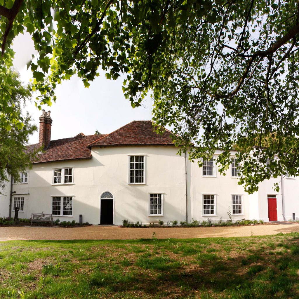
c. Bedfords Park
Located on a south-facing slope to the north west of the Landscape Scheme area, Bedford’s Park affords clear views across East London and the Land of the Fanns. Consequently, it is a significant entry point to the landscape for audiences living within this area of the Scheme.
The project will build on this natural opportunity by firstly identifying where strategic views across the landscape can be reopened, enhancing the visual connection between Bedford’s Park, the Land of the Fanns and London. Once the views have been re-established, physical interpretation and signage will then be installed to help audiences appreciate the landscape and its history. In line with the Landscape Character Assessment, these will focus on the distinct parkland character, views and natural management taking place within the area.
While these interventions represent the core of this project, opportunities to better connect local audiences to these views and the heritage interest within Bedford’s Park will be scoped further. For example, these could include the Havering-atte-Bower to Broxhill Road footpath, which could be widened to enable pedestrian access to/from Bedford’s Park and the walled garden, or even a new bridle path connecting to the existing bridle path network to keep horses off the road. Once identified, the HLF funding allocated for this project will be encouraged to be used as match-funding for funders such as the Veolia Environmental Trust for further Park related enhancements.
This project will be further developed during Year 1 of the Scheme and led by the London Borough of Havering with input from the Friends of Bedfords Park.
d. Langdon Hills
The view from Langdon Hills was described by Philip Morant in 1768 as the ‘grandest prospect in England’ as quoted in Leslie Thompson’s book ‘The Land that Fanns’ which inspired this LPS. Consequently, it is fitting that Langdon Hills should host interpretation and signage that underpins the wider ‘Land of the Fanns’ scheme.
As per the Landscape Character Assessment, the interpretation and signage will focus on the wider landscape as informed by the unique elevations and views, whilst connecting to the plotlands history and woodland management associated with this part of the landscape.
This project will be further developed during Year 1 of the Scheme and led by Thurrock Council.
e. Davy Down
With the Victorian railway viaduct and 1920s water pumping station offering a heritage interest, Davy Down also afford views and access towards the northern Mardyke Valley and the wider Land of the Fanns. Consequently, it is a significant entry point to the landscape for audiences living within this area of the Scheme.
The project will build on this natural opportunity by firstly identifying where strategic views and access to the landscape can be improved, enhancing the visual connection between Davy Down, the Mardyke Valley and the Land of the Fanns. Once the views have been re-established, physical interpretation and signage will then be installed to help audiences appreciate the landscape and its history. The historic pumping station will also accommodate further interpretation in the form of an exhibition, drawing together the unique history of water extraction at the location with that of the wider landscape.
While these interventions represent the core of this project, opportunities to develop strategic connections for local audiences to the wider landscape area will be scoped further. For example, this could include the development of a walking path connecting Davy Down to the lower Mardyke and onto Purfleet. Once identified, the HLF funding allocated for this project will be encouraged to used as match-funding for funders such as the Veolia Environmental Trust for further strategic enhancements.
This project will be further developed during Year 1 of the Scheme and led by the Land Trust.
f. Purfleet
The project aims to support progress towards restoring the High House complex in Purfleet as one of the few remaining collections of historic farm buildings in the Land of the Fanns area. In particular, the collection of buildings has left a virtually unchanged example of a high status dwelling with agricultural outbuildings within a context of intense industrial and domestic development over the last 150 years.
It will focus on interpreting the Dovecote and Farm, supporting community-led access and understanding of the heritage on-site alongside the physical regeneration taking place at High House Production Park.
This project will need to be further developed during Year 1 of the Scheme with the full support of High House Production Park Ltd secured. High House Community Group will champion the project voluntarily.
g. Thames Chase Forest Centre
The farmland surrounding Thames Chase Forest Centre was historically far more extensive, but much has since been lost to quarrying and housing development – an early casualty of the development pressure particular to our Scheme. Given the importance of farming to the historic Land of the Fanns area, there is an opportunity to engage audiences in the cultural impact associated with the landscape as a productive resource.
The project is comprised of three elements.
The first will invite local people to research and identify local stories, features and views associated with local farming, providing a body of information for interpretation whilst offering learning along the way.
The second element will translate this research into a temporary exhibition (with the potential to become permanent) that will feature within Thames Chase Forest Centre. This will be themed on the ‘productive past of the Fanns’ and include consideration of un-interpreted landscape features associated with farming, as well as consideration of new productive landscapes that have emerged as a result of the Thames Chase Community Forest Project (e.g. woodlands, craft industries etc.). Before the exhibition is made permanent, it will also be displayed elsewhere within the landscape area (e.g. Discover Me sites) so a wider audience can benefit from the project.
The third element will explore the relocation of farming artefacts from across the Land of the Fanns to Thames Chase Forest Centre as part of the exhibition once it has become a permanent feature. This may necessitate a second project phase, which will follow on from the Land of the Fanns Scheme depending on the costs of preparing the display spaces.
This project will be further developed during Year 1 of the Scheme and led by the Thames Chase Trust.